Shipping
Shipping is not included in the shop prices. The final price including shipping will be confirmed to the customer by a separate e-mail and will depend on the parcel's size and destination. We try our best to find the most economical and safe shipping way possible.
Examples of the most common shipping fees: Finland 5,90€; Sweden, Germany, Baltics 8,00€; Benelux, Denmark, Spain, Poland 12,00€; Non-EU 35,00€
terms & conditions
Before ordering we kindly ask you to read our terms and conditions.
availability
Please notice that the book selection of our online store is not available at the bookstore. If you wish to view some items, please make an order or contact us in advance.
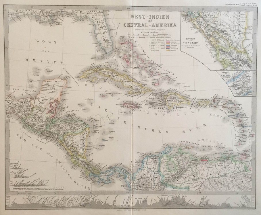
Thomson, John: West Indien und Central-America (1817)
€380,00
Description
John Thomson (1777 -ca.1840)
West Indien und Central-Amerika
19th century map of the West Indies islands in the Caribbean.
Steel engraving with coloured outlines. Good condition.
Additional information
YEAR OF PUBLICATION:
1817
Illustrations:
rajat värjätty käsin / gränskolorerad / outlines coloured
Condition:
3
Condition explanations:
(5) Mint, (4) Very good, (3) Good, (2) Fair, (1) Poor
Dimensions:
53,5 x 64 cm
Technique:
teräspiirros / stålstick / steel engraving
Other:
Thomson's New General Atlas


