Shipping
Shipping is not included in the shop prices. The final price including shipping will be confirmed to the customer by a separate e-mail and will depend on the parcel's size and destination. We try our best to find the most economical and safe shipping way possible.
Examples of the most common shipping fees: Finland 5,90€; Sweden, Germany, Baltics 8,00€; Benelux, Denmark, Spain, Poland 12,00€; Non-EU 35,00€
terms & conditions
Before ordering we kindly ask you to read our terms and conditions.
availability
Please notice that the book selection of our online store is not available at the bookstore. If you wish to view some items, please make an order or contact us in advance.
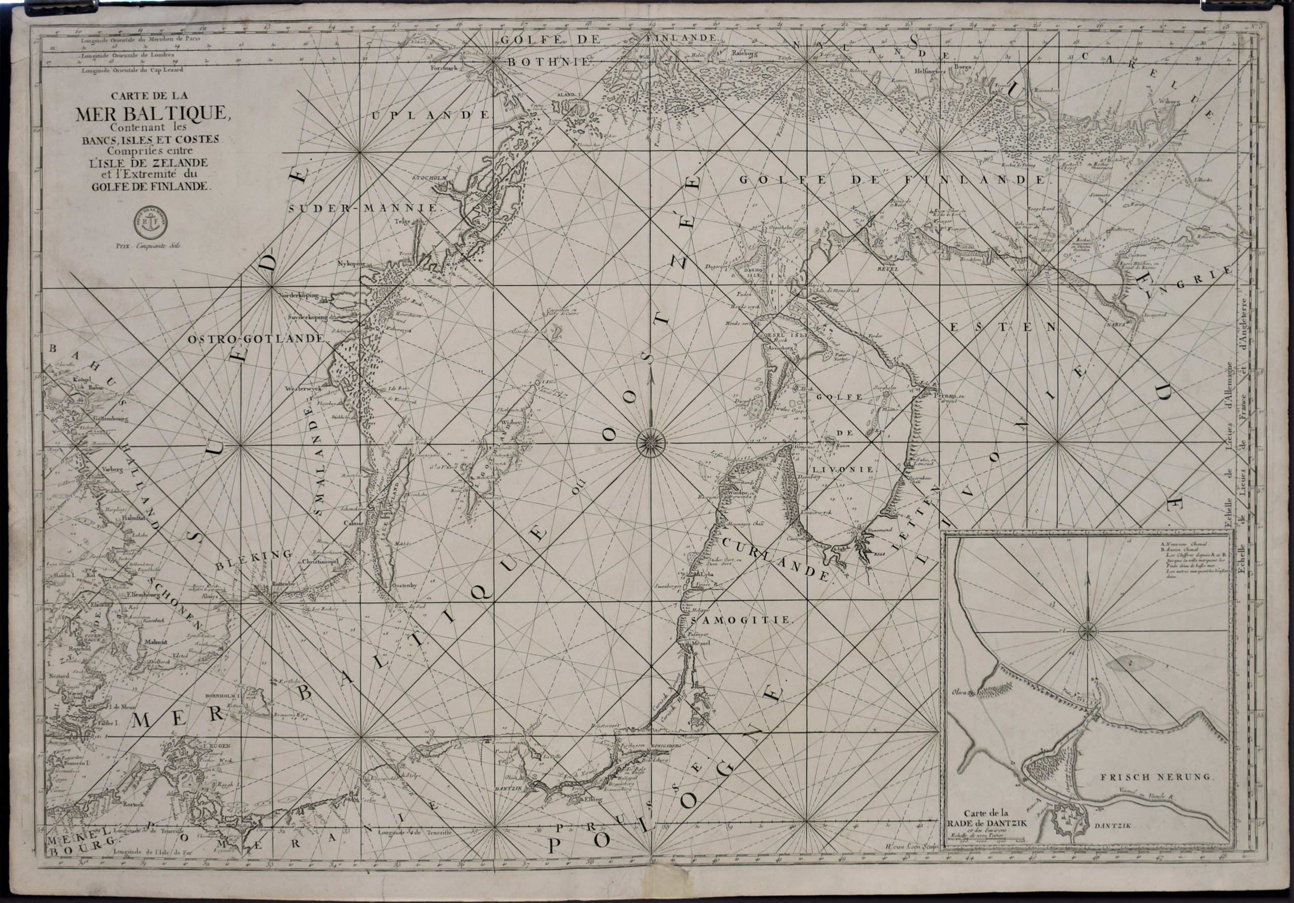
[17th century] Loon, Herman van.: Carte de la Mer Baltique (1693)
€1.600,00
Description
Herman van Loon
Carte de la Mer Baltique, contenant les bancs, isles et costes comprises entre L’Isles de Zelande et l’extreme du Golfe de Finlande
Late 17th century sea chart of the Baltic Sea by Herman van Loon (sculpt.). Uncoloured copper engraving.
Large map depicting the area from Gothenburg to River Neva. Inset map of Dantzik (Dantzig / Gdansk) on the lower right corner. Compass rose in the middle. Interesting map with place names and topographic information along the coastlines.
Good condition.
Additional information
Publisher:
Dépôt de la Marine
YEAR OF PUBLICATION:
ca. 1693
PLACE OF PUBLICATION:
Paris
Condition:
Good condition
Dimensions:
62 × 90 cm
Technique:
Copper engraving


