Shipping
Shipping is not included in the shop prices. The final price including shipping will be confirmed to the customer by a separate e-mail and will depend on the parcel's size and destination. We try our best to find the most economical and safe shipping way possible.
Examples of the most common shipping fees: Finland 5,90€; Sweden, Germany, Baltics 8,00€; Benelux, Denmark, Spain, Poland 12,00€; Non-EU 35,00€
terms & conditions
Before ordering we kindly ask you to read our terms and conditions.
availability
Please notice that the book selection of our online store is not available at the bookstore. If you wish to view some items, please make an order or contact us in advance.
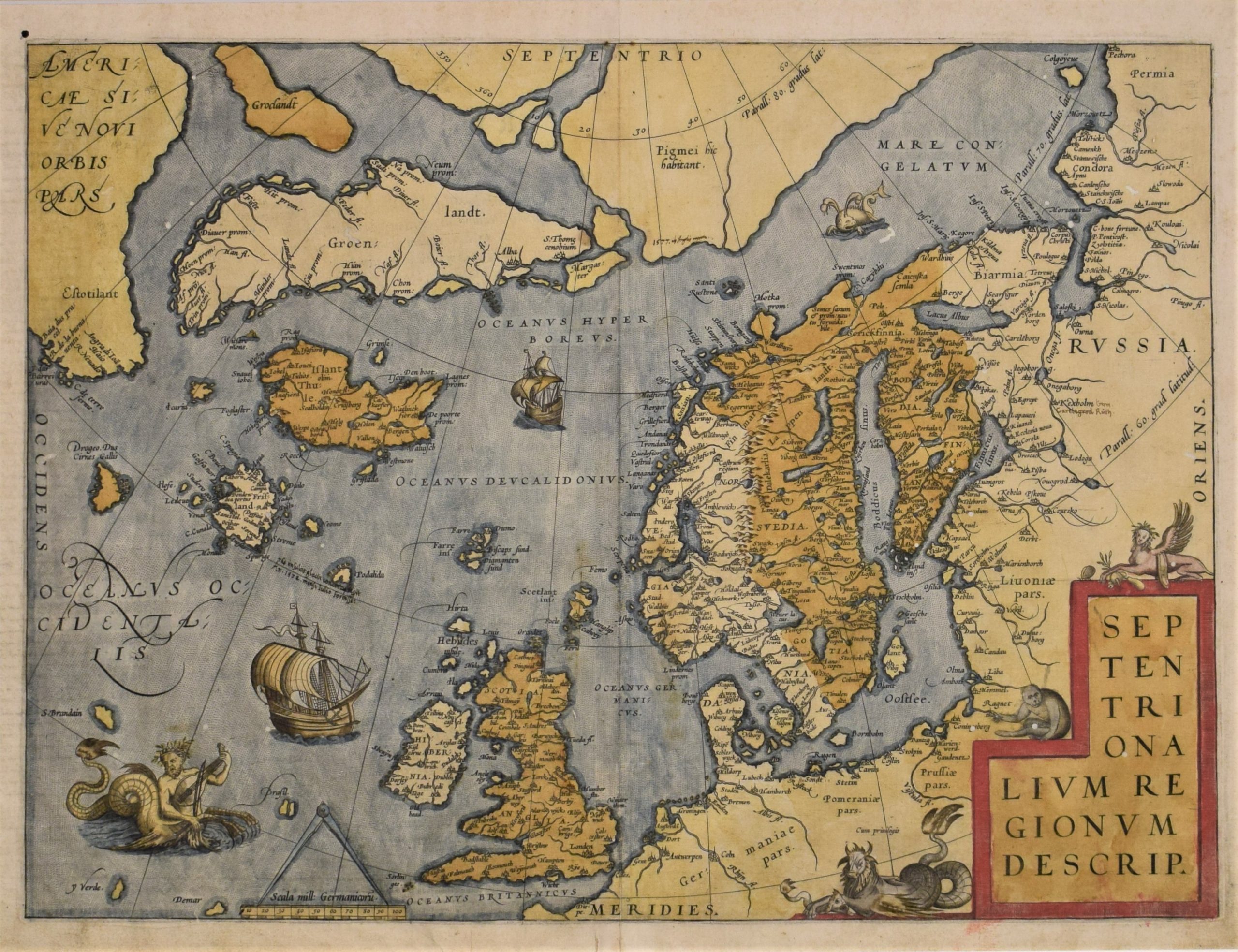
[16th century] Ortelius, A.: Septentrionalium Regionum Descrip. (1575)
€2.500,00
Description
Abraham Ortelius (1527-1598)
Septentrionalium Regionum Descrip.
16th century copper engraving of Scandinavia. Hand-coloured.
Important map of the Scandinavia and the Arctic regions by cartographer Abraham Ortelius. Several non-existent islands, sea monsters, mythological animals and naval ships charted on the map.
This Latin edition of the map is from 1570s, with Narva misspelled as Narna and Livoniae without dot on the second i.
Good overall condition with deep old colour. Several small wormholes.
Additional information
YEAR OF PUBLICATION:
ca. 1575
PLACE OF PUBLICATION:
Antwerp
Condition:
Wormholes
Dimensions:
36,5 x 49,5 cm
Technique:
Copper engraving
Other:
Latin edition


